Horse Trails
Horse Trails
Pinckney Recreation Area - alisonpaine added this area
Pinckney, MI
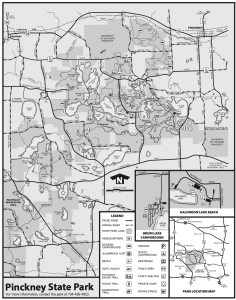
 Printable Map
-
 Directions
×
Directions
×Driving Directions
Click the icon for directions in google.West of hwy 23 on M-36 through Pinckney, left on Cedar Lake Road, then right on Monks Road. Staginf area is about a mile west on the left side of the road. Monks Road, Pinckney, MI. Large maintained staging area.
-

- ☆☆☆☆☆
 Printable Map
-
 Directions
×
Directions
×Driving Directions
Click the icon for directions in google.West of hwy 23 on M-36 through Pinckney, left on Cedar Lake Road, then right on Monks Road. Staginf area is about a mile west on the left side of the road. Monks Road, Pinckney, MI. Large maintained staging area.
- ☆☆☆☆☆
No Rides Found Be the first to Add Your Ride
Staging area is on Monks Road, with potable water and vault toilets, a shelter and picnic tables. If you wish to camp, Hell Creek Campground is very close, you can rent a stall for horses. The trails have wooded areas, some hills, open field areas, very diverse!
Land manager is Michigan Department of Natural Resources – http://www.michigandnr.com/parksandtrails/Details.aspx?type=SPRK&id=484
Should have a yearly DNR sticker on your vehicle to park. Department of Natural Resources. Silver Lake Road, Pinckney. Trails are shared with hunters during season, so be aware of the hunting dates. Bikes hold races at various times, so visit the Pinckney Trail Riders Association website for notices. Joining the club is appreciated as the club does all the trail clearing!
Like our content?
Then you’ll love our newsletter.
New horse camps and trailheads, gear reviews, tips, videos, inspiring stories and more.


