Horse Trails
Horse Trails
McDowell Mountain Regional Park - TrailMeister added this area
Scottsdale, AZ
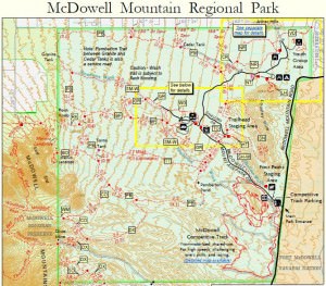
 Printable Map
 Smart Map
-
 Directions
×
Directions
×Driving Directions
Click the icon for directions in google.From central Phoenix, take Loop 202 east to Beeline Highway (SR 87). Continue northeast on SR 87 to Shea Blvd. Travel west on Shea Blvd. to Saguaro Blvd.; turn north. Continue through Town of Fountain Hills to Fountain Hills Blvd; turn right and travel four miles to the McDowell Mountain Regional Park entrance.
-

- ☆☆☆☆☆
 Printable Map
 Smart Map
-
 Directions
×
Directions
×Driving Directions
Click the icon for directions in google.From central Phoenix, take Loop 202 east to Beeline Highway (SR 87). Continue northeast on SR 87 to Shea Blvd. Travel west on Shea Blvd. to Saguaro Blvd.; turn north. Continue through Town of Fountain Hills to Fountain Hills Blvd; turn right and travel four miles to the McDowell Mountain Regional Park entrance.
- ☆☆☆☆☆

string(65) "https://trailmeister.com/wp-content/uploads/2013/12/mcdowell3.jpg"

string(64) "https://trailmeister.com/wp-content/uploads/2013/12/mcdowell.jpg"

string(65) "https://trailmeister.com/wp-content/uploads/2013/12/mcdowell1.jpg"

string(65) "https://trailmeister.com/wp-content/uploads/2013/12/mcdowell2.jpg"

No Rides Found Be the first to Add Your Ride
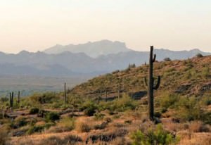
Nestled in the lower Verde River basin, this 21,099-acre park is a desert jewel. Riders will enjoy over 50 miles of multi-use trails, and spectacular views of the surrounding mountain ranges.
- Land Manager is Maricopa County Parks Department
- Day use only
Like our content?
Then you’ll love our newsletter.
New horse camps and trailheads, gear reviews, tips, videos, inspiring stories and more.


