Horse Trails
Horse Trails
Line Creek Stock Campground - tracy-gravelle added this area
St. Regis MT, ID
-
 Directions
×
Directions
×Driving Directions
Click the icon for directions in google.I-90 East from CDA ID to St. Regis MT. Get off at exit and go west along the frontage road for less than a mile and there will be a fork in the road. Take the Left fork following the \"Little Joe Road\". The first 15 miles to the top of Gold Pass is gravel but it is very wide and usually quite smooth. Then at Gold Pass it becomes pavement. Take this for another 15 miles and between the 77 and 76 mile markers there is the Red Ives Road 218 to the south. Take this for 11 miles to Line Creek Stock Campground. Alternative wa, all paved: I-90 East from CDA, take Rose Lake St. Maries exit. Just before getting into St. Maries on Hwy 3 turn east on Forest Highway 50. Follow the St. Joe River to the 76 mile marker and turn south onto the Red Ives Road 218; Go for 11 miles to Line Creek Stock CG.
-

- ☆☆☆☆☆
-
 Directions
×
Directions
×Driving Directions
Click the icon for directions in google.I-90 East from CDA ID to St. Regis MT. Get off at exit and go west along the frontage road for less than a mile and there will be a fork in the road. Take the Left fork following the \"Little Joe Road\". The first 15 miles to the top of Gold Pass is gravel but it is very wide and usually quite smooth. Then at Gold Pass it becomes pavement. Take this for another 15 miles and between the 77 and 76 mile markers there is the Red Ives Road 218 to the south. Take this for 11 miles to Line Creek Stock Campground. Alternative wa, all paved: I-90 East from CDA, take Rose Lake St. Maries exit. Just before getting into St. Maries on Hwy 3 turn east on Forest Highway 50. Follow the St. Joe River to the 76 mile marker and turn south onto the Red Ives Road 218; Go for 11 miles to Line Creek Stock CG.
- ☆☆☆☆☆
No Rides Found Be the first to Add Your Ride
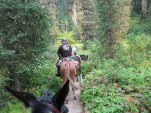
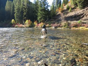
This trail follows the St. Joe Wild and Scenic River. There is an FS stock campground (Line Creek) with hitch rails, highlines, pull thru camp sites with fire grates where you can park for overnight trips or stay for day trips. Limited grazing in the area so bring feed. Call the District for information on loops from this outstanding trail. The trail follows the river for 18 miles with various small campsites and loops available along the way. There are many loops for day rides or packing and camping to enjoy. The river is on the \”wild\” part and is non-motorized. There is an outfitter\’s lodge 5 miles from the trailhead at Spruce Tree CG. the first 5 miles of the trail traverses through a gentle terrain along the river. After that point the trail traverses steeper ground and the tread is narrow in places. The CG can be busy on weekends but there is dispersed camping available in the area if you have a way to keep your stock.
There is nearby access to several trails – Indian Peak #284, Copper Creek #477, Copper Ridge #263, Line Creek #279, and St. Joe River #48.
Land Manager is Idaho Panhandle National Forest – St Joe Ranger District – https://www.fs.usda.gov/recarea/ipnf/recarea/?recid=6910
The St. Joe Ranger District has written material describing the trails in this area available upon request.
Non-motorized, late summer there can be fire restrictions depending on the year.
Like our content?
Then you’ll love our newsletter.
New horse camps and trailheads, gear reviews, tips, videos, inspiring stories and more.


