Horse Trails
Horse Trails
Hay Creek Day Use Area - tinedonahue added this area
Red Wing, MN
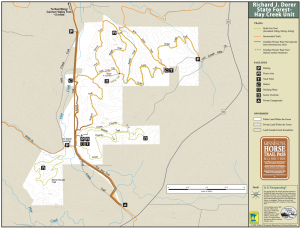
 Printable Map
-
 Directions
×
Directions
×Driving Directions
Click the icon for directions in google.From Red Wing take State Hwy. 58 (S) 4 mi.; turn right (NW) at Dressen's Saloon; go 1.25 mi. on a gravel road.
-

- ☆☆☆☆☆
 Printable Map
-
 Directions
×
Directions
×Driving Directions
Click the icon for directions in google.From Red Wing take State Hwy. 58 (S) 4 mi.; turn right (NW) at Dressen's Saloon; go 1.25 mi. on a gravel road.
- ☆☆☆☆☆
No Rides Found Be the first to Add Your Ride
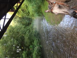
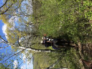
There are about 15 miles of marked trails in this area and 2 water crossings. There are also many goat trails that can make the trail a little more challenging but lead to great views of the valley. A lot of hills and bluffs, some wide trails, but many small trails in the forest. The whole trail system is mostly in wooded forest, some hardwood, and some pine. There are some rocky areas, and the forest management have put crushed rock on some of the wider trails, but otherwise is is sand or dirt. Goat trails can get slippery after rains, but are still ok to ride. The park itself does not have camping, but there is a private horse camp adjacent to the park that is very popular. Otherwise there is a day camp area for trailer parking and a bathroom. Great place to ride.
Land manager is Minnesota Dept of Natural Resources – http://www.dnr.state.mn.us/state_forests/facilities/cmp00040/index.html
Phone: 651-345-3401
Managed by: Frontenac State Park
Like our content?
Then you’ll love our newsletter.
New horse camps and trailheads, gear reviews, tips, videos, inspiring stories and more.


