Horse Trails
Horse Trails
Hat Rock State Park - TrailMeister added this area
Umatilla, OR
Riders have logged 4.02 miles & 2.15 hours here.
TOP TRAIL RIDER: caroleschuh logged 4.02 miles.
 Printable Map
-
 Directions
×
Directions
×Driving Directions
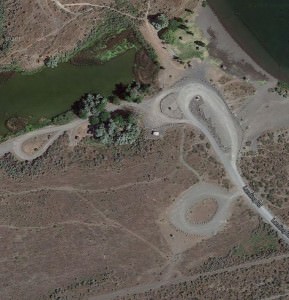
Click the icon for directions in google.Between Oregon Milepost 194 and 193 turn left at Hwy 37 (across from the Weigh Station) go 100 feet or so and take the gravel road to the right, down under the Hwy to the park. Horse trailers park on the left in designated area or along the access road if full.
-

- ☆☆☆☆☆
 Printable Map
-
 Directions
×
Directions
×Driving Directions
Click the icon for directions in google.Between Oregon Milepost 194 and 193 turn left at Hwy 37 (across from the Weigh Station) go 100 feet or so and take the gravel road to the right, down under the Hwy to the park. Horse trailers park on the left in designated area or along the access road if full.
- ☆☆☆☆☆

string(63) "https://trailmeister.com/wp-content/uploads/2014/01/hatrock.jpg"

string(64) "https://trailmeister.com/wp-content/uploads/2014/01/hatrock1.jpg"
string(64) "https://trailmeister.com/wp-content/uploads/2014/01/hatrock2.jpg"
string(64) "https://trailmeister.com/wp-content/uploads/2014/01/hatrock3.jpg"
string(64) "https://trailmeister.com/wp-content/uploads/2014/01/hatrock4.jpg"
Rides Add Your Ride
| Date | Rider | Hours | Minutes | Miles | GPS | Photos | Rating | |
|---|---|---|---|---|---|---|---|---|
| 30 Jan 2016 | caroleschuh | Ride Notes | 2 h | 9m | 4.02 | ✔ | ☆☆☆☆☆ |
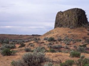
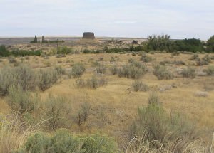
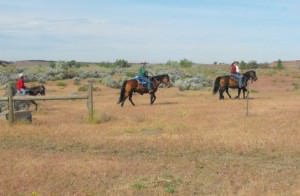
Day ride next to the Columbia River in a desert oasis surrounded by rolling sagebrush hills and outcroppings of basalt. Also known as “Warehouse Beach” this is a popular spot for horse and mule riders to venture off trail.
- Land Manager is Oregon Parks & Recreation Department
- Day use only
Like our content?
Then you’ll love our newsletter.
New horse camps and trailheads, gear reviews, tips, videos, inspiring stories and more.


