Horse Trails
Horse Trails
Fourteen Mile Trailhead - 1trailmeister added this area
Loomis, WA
Riders have logged 6.65 miles & 4.67 hours here.
TOP TRAIL RIDER: 1trailmeister logged 6.65 miles.
-
 Directions
×
Directions
×Driving Directions
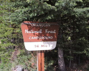
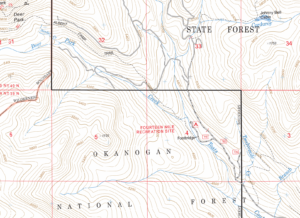
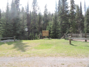
Click the icon for directions in google.From the town of Loomis, travel north on County road #9425 for 2 miles to junction of #9425 and County road #4066. Turn West on County road #4066 which becomes Forest Service Road #39. Continue 9 miles on Forest Service Road #39 to junction of DNR T-1000. Travel 3 miles on the DNR T-1000 to the Forest Service boundary where the road turns into Forest Service Road #100 road. Travel another .5 mile to the junction with the Forest Service Road# 110. Turn left onto the Forest Service #110 road and drive .1 mile to the Fourteen Mile Trailhead and Campground entrance.
-

- ☆☆☆☆☆
-
 Directions
×
Directions
×Driving Directions
Click the icon for directions in google.From the town of Loomis, travel north on County road #9425 for 2 miles to junction of #9425 and County road #4066. Turn West on County road #4066 which becomes Forest Service Road #39. Continue 9 miles on Forest Service Road #39 to junction of DNR T-1000. Travel 3 miles on the DNR T-1000 to the Forest Service boundary where the road turns into Forest Service Road #100 road. Travel another .5 mile to the junction with the Forest Service Road# 110. Turn left onto the Forest Service #110 road and drive .1 mile to the Fourteen Mile Trailhead and Campground entrance.
- ☆☆☆☆☆
Rides Add Your Ride
| Date | Rider | Hours | Minutes | Miles | GPS | Photos | Rating | |
|---|---|---|---|---|---|---|---|---|
| 03 Aug 2016 | 1trailmeister | Ride Notes | 4 h | 40m | 6.65 |  |
☆☆☆☆☆ |
With easy access into the Pasayten Wilderness area the fourteen mile trailhead makes a good jump off point.
Enjoy this video on the Pasayten Wilderness from the Jan 2017 episode of Coffee with TrailMeister.
Here’s a Pasayten tip from TrailMeister user Mike M
When riding on Amphitheater Mountain out of Spanish camp.
When you get to the top of Amphitheater there is a small area of rocks where you have to stop with the horses. There are no trees there to tie to. So someone usually has to stand and hold the horses while the others climb up the rocks for the spectacular view and photo shoot. There is a LARGE tilted rock leaning on an even bigger rock down where the horses have to stop. Take a pack rope with you on the ride up. Throw the pack rope thru the gap between the rocks then tie it tight in a band around the tilted boulder. Then tie the horses to the band rope and everyone can enjoy the view together. It has worked for me many times.
Land manager is Okanogan – Wenatchee National Forest – http://www.fs.usda.gov/recarea/okawen/recarea/?recid=59577
Certified weed free feed is required
Fee / Northwest Forest pass required here
Like our content?
Then you’ll love our newsletter.
New horse camps and trailheads, gear reviews, tips, videos, inspiring stories and more.


