Horse Trails
Horse Trails
Elijah Bristow State Park - 1trailmeister added this area
Dexter, OR
Riders have logged 72.45 miles & 22.25 hours here.
TOP TRAIL RIDER: crowguys logged 58.25 miles.
 Printable Map
-
 Directions
×
Directions
×Driving Directions
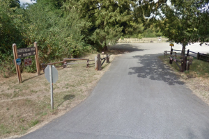
Click the icon for directions in google.From Eugene, I-5 south to exit 188-A and follow Highway 58 toward Klamath Falls/Oakridge. After 10 miles, turn left on Rattlesnake Road. Drive 0.2 mile and turn right on Wheeler Road. The equestrian trailhead parking area is on the left in 0.3 mile.
-

- ★★★★★
 Printable Map
-
 Directions
×
Directions
×Driving Directions
Click the icon for directions in google.From Eugene, I-5 south to exit 188-A and follow Highway 58 toward Klamath Falls/Oakridge. After 10 miles, turn left on Rattlesnake Road. Drive 0.2 mile and turn right on Wheeler Road. The equestrian trailhead parking area is on the left in 0.3 mile.
- ★★★★★

string(64) "https://trailmeister.com/wp-content/uploads/2015/12/elijahb1.png"
string(64) "https://trailmeister.com/wp-content/uploads/2015/12/elijahb2.png"
string(64) "https://trailmeister.com/wp-content/uploads/2015/12/elijahb3.png"
string(68) "https://www.trailmeister.com/wp-content/uploads/2019/02/IMG_1749.jpg"
Rides Add Your Ride
| Date | Rider | Hours | Minutes | Miles | GPS | Photos | Rating | |
|---|---|---|---|---|---|---|---|---|
| 06 Jul 2021 | crowguys | Ride Notes | 2 h | 0m | 6 | ★★★★★ | ||
| 05 Jul 2021 | crowguys | Ride Notes | 1 h | 30m | 4.75 | ★★★★★ | ||
| 11 Jul 2021 | crowguys | Ride Notes | 1 h | 30m | 4.75 | ★★★★★ | ||
| 01 Oct 2021 | crowguys | Ride Notes | 1 h | 30m | 4.75 | ★★★★★ | ||
| 15 Oct 2021 | crowguys | Ride Notes | 1 h | 30m | 4.75 | ★★★★★ | ||
| 03 Oct 2021 | crowguys | Ride Notes | 1 h | 30m | 4.75 | ★★★★★ | ||
| 06 Sep 2021 | crowguys | Ride Notes | 1 h | 30m | 4.75 | ✔ | ★★★★★ | |
| 03 Sep 2021 | crowguys | 1 h | 30m | 4.75 | ★★★★★ | |||
| 20 Aug 2021 | crowguys | Ride Notes | 1 h | 30m | 4.75 | ★★★★★ | ||
| 24 Dec 2020 | crowguys | Ride Notes | 1 h | 45m | 4.75 | ★★★★★ | ||
| 01 Jan 2021 | crowguys | Ride Notes | 1 h | 45m | 0 | ★★★★★ | ||
| 09 Aug 2020 | carly-skenkur | Ride Notes | 1 h | 45m | 5.5 | ✔ | ★★★★☆ | |
| 29 May 2020 | crowguys | Ride Notes | 1 h | 30m | 4.75 | ✔ | ★★★★★ | |
| 08 Jul 2019 | crowguys | Ride Notes | 1 h | 30m | 4.75 | ★★★★★ | ||
| 04 Apr 2018 | gmd | 0 h | 0m | 8.7 | ✔ | ★★★★★ |
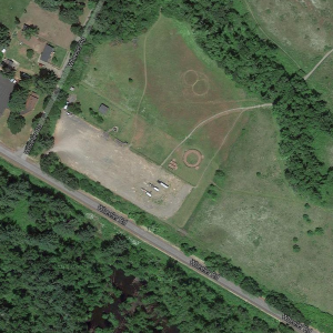
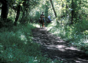
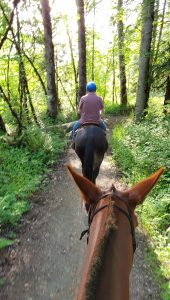
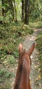
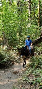
Elijah Bristow State Park is located on the Middle Fork of the Willamette River, and is easy to reach via State Highway 58 southeast of the Eugene. The park was named for one of the first pioneer settlers in Lane County and is comprised of 847 acres of scattered meadows, woodlands and wetlands. Over 10 miles of looping and winding horse friendly trails are the draw for equestrians!
Like our content?
Then you’ll love our newsletter.
New horse camps and trailheads, gear reviews, tips, videos, inspiring stories and more.


