Horse Trails
Horse Trails
Coyote Meadow - 1trailmeister added this area
Sonora, CA
-
 Directions
×
Directions
×Driving Directions
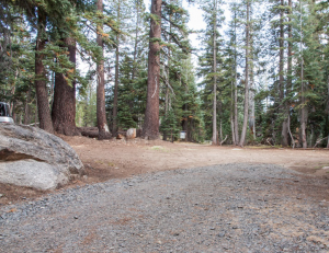
Click the icon for directions in google.From Highway 108 turn onto Herring Creek Road (4N12) and go 7.1 miles to the Y-junction which starts the Hammill Canyon loop road. At the junction go right on the gravel road and after 2.9 miles you will reach the Pinecrest Peak junction turnoff. Continue on 4N12 for 1.9 miles to the junction with Forest Service road 5N67. This road is signed only with a standard Forest Service stake, but it is the only forest road after the Pinecrest junction. Proceed on 5N67 1.0 miles to the trailhead.
-

- ☆☆☆☆☆
-
 Directions
×
Directions
×Driving Directions
Click the icon for directions in google.From Highway 108 turn onto Herring Creek Road (4N12) and go 7.1 miles to the Y-junction which starts the Hammill Canyon loop road. At the junction go right on the gravel road and after 2.9 miles you will reach the Pinecrest Peak junction turnoff. Continue on 4N12 for 1.9 miles to the junction with Forest Service road 5N67. This road is signed only with a standard Forest Service stake, but it is the only forest road after the Pinecrest junction. Proceed on 5N67 1.0 miles to the trailhead.
- ☆☆☆☆☆
No Rides Found Be the first to Add Your Ride
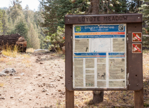
Coyote Meadows is a popular starting point for packers heading into the Emigrant Wilderness. The trail for here visits Cooper meadow, Hay meadow, White sides meadow, Eagle Meadow and more. Views include the myriad of lava formations that line the ridges around Cooper Peak. These geologic monuments are extraordinary.
Many thanks to the Mid Valley Unit of the Back Country Horsemen of California for sharing this area!
- Land manager is Stanislaus National Forest – http://www.fs.usda.gov/recarea/stanislaus/recarea/?recid=81682
- No fees
Like our content?
Then you’ll love our newsletter.
New horse camps and trailheads, gear reviews, tips, videos, inspiring stories and more.


