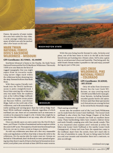
 It’s hard to believe that we’re already six months through the year. Time does fly, especially when you’re riding in a wilderness area! One of my favorite things about the month of June is the long days of summer leading up to and around the summer solstice when the northern portion of the planet is tilted furthest towards the sun. This maximal tilting in turn gives us these wonderfully long summer days when the sun seems to stand still. To take the fullest advantage of the these extended summer days let’s explore three new wilderness areas all of which are great for day rides. First we’ll venture into an oxymoron, a desert ride in the Evergreen State of Washington. For the second wilderness we’ll show you the ominously named Devils Backbone Wilderness located in the Eden of the Missouri Ozarks. Thirdly we’ll explore Colorado’s Lost Creek Wilderness only a short distance from the hustle and bustle of Denver.
WA – BLM Juniper Dunes
Trailhead Coordinates: 46.428587, -118.82527
Despite the common notion that Washington state is filled with cool mists and covered in ferns and towering firs, the fact of the matter is that a majority of the state is desert. The Cascade Mountain range casts a rain shadow effect over the eastern two thirds of the state. This arid eastern landscape is home to the Juniper Dunes Wilderness area; 7,140 acres of massive windswept sand dunes and of few stands containing the northernmost specimens of western juniper trees (the only trees in the area). As might be guessed from the landscape this area takes quite a pounding from the elements. Frequent strong winds combine with the lack of moisture, and high summertime heat to create a desert environment that is an absolute delight to ride through. The feeling as you ride through sand dunes that are over a hundred feet high and tens times that long is amazing.
Getting to the Juniper Dunes area can be more of a challenge than the riding. The “official”Bureau of Land Management access route is from the south, unfortunately this route forces riders to to pass through about six miles of a heavily used OHV area before they reach the serenity of the wilderness where motorized vehicles are not allowed. A better choice is to enter from the north, courtesy of a local rancher who has reached an agreement with the BLM. From this parking area riders have only to ride about 200 yards before they enter the wilderness area.
Once you’ve entered this desert oasis of dunes and saharan scenery you’ll find that there are no maintained trails and that this is open country riding. Since there are no trails to guide you be sure to keep an steady eye on your location, and most importantly where you are in relation to the parking area. This is an area where a GPS unit can be handy for there are few natural landmarks to help guide your way.
Although disbursed camping is allowed within Juniper Dunes the lack of water makes this area best suited for day rides, a rarity amongst wilderness areas, many of which can only be reached after a few hours on the trail.
 MO – Mark Twain National Forest, Devils Backbone Wilderness
Trailhead Coordinates: 36.719403, -92.144909
Southwest Missouri is home to the Ozarks, the Mark Twain National Forest, and the Devils Backbone Wilderness. This nearly 7,000 acre area features the kind of rugged topography that you might expect from its evocative name. Long narrow ridges reach within the wilderness before dropping into the deep forested hollow that flank them.
With three equine friendly trailheads access into the Devils backbone is pretty straight forward. I found that entering this wilderness area was easier from the southern end, at the Collins Ridge trailhead. The other two equine access points are Raccoon Hollow, and McGarr Ridge; both on the north side of the wilderness, and with somewhat less trailer parking and turning space than the Collins Ridge Trailhead. While trailhead camping is allowed, regardless of which trailhead you use, there are no amenities such as restrooms or corrals so be prepared to rough it a bit. A better idea might be to venture into the wilderness to set up camp, after all that’s why we’re here!
Once you decide on an entry point into the Devils Backbone you’ll have 13 miles of maintained trails to explore within the area’s 6,687 acres. The majority of trails here form broad loops that you can use to create a route as long as you desire.
As with any wilderness area there are a few very reasonable rules and regulations to follow that help to keep the wild in the wilderness. ON the equine side the major ones are: Groups are limited to 10 heartbeats, don’t tie directly to trees, spread out grazing (not that there’s much of that in this heavily forested environment!), and picket your animals at least 200 from water sources.
With this area being heavily forested in oaks, hickories, and pines, one of the best times to visit is in the fall as the broad leaved trees are bursting into vibrant colors. Fall is also a great time to avoid summer’s heat and humidity. That being said the mild Ozark climate makes it possible to visit and enjoy yourself during any part of the year.
 CO – Lost Creek Wilderness, Pike National Forest
Trailhead Coordinates: 39.169102, -105.372110
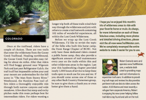
Only 60 miles from downtown Denver Colorado lies the Lost Creek Wilderness. An area covering nearly 120,000 acres filled with many glorious features including fantastic rounded granite knobs and spires. It’s been said that these spectacular rock formations are among the best in the entire Rocky Mountain range. That’s saying something!
Access into the southern end of the Lost Creek Wilderness can be made from the Goose Creek Trailhead. The Goose Creek trailhead is also where the Front Range Chapter of the Back Country Horsemen of Colorado has built an excellent horse camp. These hardworking riders have created a distinct horse and mule friendly camping area with four sturdy corrals. This is a very important thing since equines aren’t welcome at either the hiker only Goose Creek Trailhead or the nearby Goose Creek Campground. A horse trail runs from the equestrian camp to the trailhead. Apart from the corrals there isn’t much else in the way of amenities in camp. Be sure to bring water for both you and your mounts and remember that there isn’t a restroom so plan accordingly.
Once you’ve made it to the trailhead risers have a couple of choices to make. There are two trails that enter the wilderness from the Goose Creek Trailhead. Heading northbound the Goose Creek Trail provides easy riding for about 6 miles. After that riders will find boggy ground near Wigwam park and just just Refrigerator Gulch the trail is all but impassable unless your and your mount are fans of the hill scene from the movie “The man from Snowy River”. Westbound, the Hankins pass trail offers riders a thoroughly enjoy ride through both narrow canyons and wide meadows. A few short, but steep and rocky pitches make this route perhaps best for intermediate riders. For riders wanting a longer trip both of these trails wind their way through the wilderness and join with others to create a trail network containing 102 miles of wonderful experiences; all within the Lost Creek Wilderness.
Before we wrap up the Lost Creek Wilderness I’d like to revisit the topic of the folks who built this horse camp, the Front Range Chapter of BCHC. Not only have these dedicated riders created a public horse camp they also provide a significant amount of trail maintenance every year on the trails within this and other wilderness areas in the region. Last year this hardworking chapter provided nearly a thousand hours of service to keep these trails open to stock use for you and me. If you should come across one of these or any other Back Country Horsemen group be sure to give them a thank you or even better give them a hand.
I hope you’ve enjoyed this month’s trio of wilderness areas to ride with your favorite horse or mule. As always for more information on each of these fabulous areas, including more photos and detailed driving directions, please visit the all new www.TrailMeister.com. We’ve completely revamped the entire website to make it easier for you to use.