 Celebrate Earth Day Earth Day Horse Rides in VA, GA, and AZ
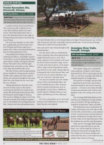
As Published in Trail Rider Magazine April 2017 issue
The 22nd of April marks the 47th anniversary of Earth Day; a day to celebrate the environment and encourage outdoor activities. Let’s brave April’s showers with Earth Day rides in three wonderful spring horse riding destination points across the U.S. from the verdant east to the desert southwest. We’ll start in Virginia’s Fox Creek Horse Camp then head south to Georgia’s Ocmulgee River Trail system, then veer west for a visit to Arizona’s Frazier Recreation Site.
QUICK FACT – Started in 1970, Earth Day is the largest secular holiday in the world with over a billion people doing something outdoor related each year on April 22nd.
 Fox Creek Horse Camp, Troutdale, Virginia –
www.trailmeister.com/trails/fox-creek-horse-camp/
GPS coordinates: 36.69800, -81.50369
QUICK FACT – Rodgers Mountain and Rodgers National Recreation Area are named after William Barton Rogers; the founder of the Massachusetts Institute of Technology (MIT).
Southwest Virginia is home to the Fox Creek Horse Camp in the Mount Rogers National Recreation Area. With over 100 miles of horse friendly trails and a camp area that is equally easy to get into and out of, this a fabulous place to ride, camp, and reconnect with the outdoors.
The amenities at Fox Creek are on the Spartan side with camp sites arranged around a loop drive. Each of the 32 camp sites offer a picnic table, fire ring, and picket line posts. Between the months of April and October portable toilets will be found scattered around the camp. The eponymous Fox Creek flows past the campground and provides stock water.
A camp host looks after the camp throughout the summer months and keeps an eye of things.
Horse campers looking for a few more frills can visit the nearby Grindstone campground for hot showers, potable water spigots, and a dump station. Another alternative for horse campers is Grayson Highlands State Park on the opposite side of Mount Rodgers.
As you ca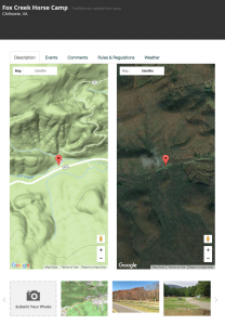 n tell the Fox Creek horse camp is more about the riding than the camping. It’s the wonderful trails here that attract many riders each year. The Mount Rodgers High Country area that surrounds the camp contains arguably the finest horse riding opportunities in Virginia.
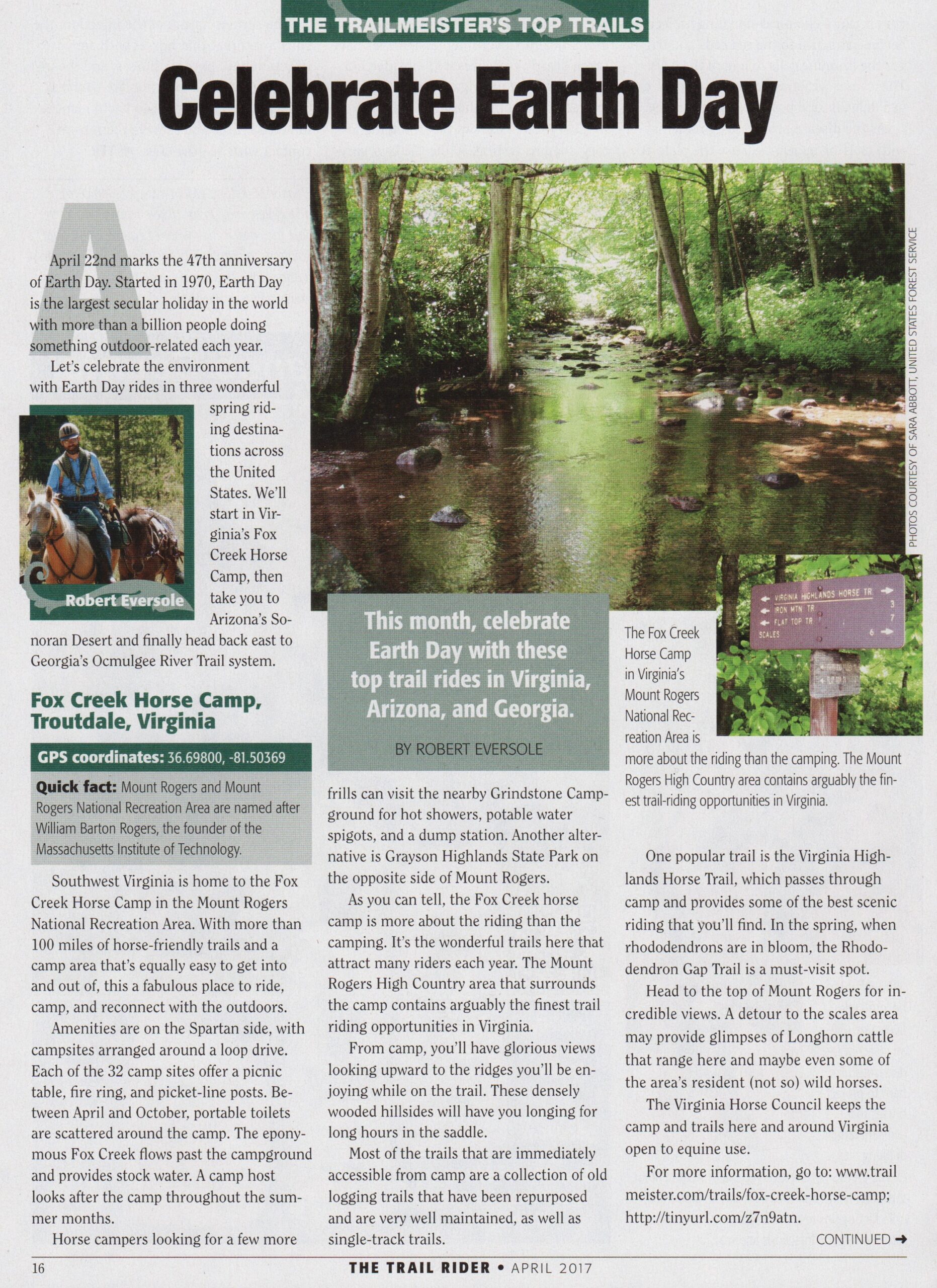
From camp, you’ll have glorious views looking upwards to the ridges you’ll be enjoying while on the trail. These densely wooded hillsides will have you longing for long hours in the saddle.
Most of the trails that are immediately accessible from camp are a collection of old logging trails that have been repurposed and are very well maintained as well as single track trails. One of the most popular trails here is the Virginia Highlands Horse Trail which passes through camp and provides some of the best scenic riding that you’ll find regardless of where you call home. When in bloom, the Rhodendron gap trail is a must visit spot.
Some favorite areas to visit here include the top of Mount Rodgers where the views are incredible. A detour to the scales area may provide glimpses of longhorn cattle that range here and maybe even some of the area’s resident (not so) wild horses.
Visitors during this time of year will enjoy masses of rhododendrons blooming. Summer visitors will welcome an escape from the heat found at lower elevations. Fall trail riders will find the area spectacular and filled with vivid colors of changing leaves.
Before putting a trip to Fox Creek on your calendar make sure that you also remembered to get your Coggins papers before you visit. The Mt Rogers National Recreation Area which administers the campground requires current papers for each equine brought here.
Many thanks to the Virginia Horse Council for all their work to keep the camp and trails here and around Virginia open to equine use.
For more information, go to: https://www.trailmeister.com/trails/fox-creek-horse-camp/
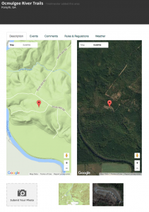
 Ocmulgee River Trails, Forsyth, Georgia
www.trailmeister.com/trails/ocmulgee-river-trails/
GPS Coordinates: 33.2091, -83.8170
Sixty miles southeast of Atlanta, in the Oconee National Forest, is where you’ll find this popular riding area. This is a great place for day rides as well horse camping with trails meandering along the Ocmulgee River.
This portion of Georgia’s red dirt hills, blanketed by pine forest, and rich bottomlands shaded by the forest’s towering canopies are home to over thirty miles of equestrian friendly trails. The area is beautiful and you can see the glimpses of the river during most of your rides.
The Ocmulgee Bluff trail area is the main day use riding area and has a very large parking area that can hold 20 – 30 truck trailer rigs. Parking area amenities include picnic tables and toilets in addition to the large parking area. This destination area is a favorite for all outdoor enthusiasts from horse riders to hikers, bicyclists, and picnickers, so be prepared to share. Local horsemen and trail advocacy groups, including the Georgia Horse Council have made numerous recent improvements in both the trailhead area as well as the trails themselves.
QUICK FACT – The name Ocmulgee comes from native American words oki (water) and molki (bubbling) roughly translating to “where the water boils up”
 Trails near the Bluff trailhead area, and north are generally hilly as you ride down, over, and through the ravines of tributaries feeding the Ocmulgee. The rolling terrain drains rainfall more easily than flat areas so the trails here dry quicker than others in the area.
A favorite ride from the bluff is to the “swimming hole”. A quick half hour ride from the trailhead and you’ll find a broad sandy beach that makes a perfect swimming and lunch stop.
Located just a short distance to the south of the Ocmulgee Bluffs area is the Ocmulgee Horse Camp. For horse campers spending more time on the trails beside the Ocmulgee River this is a great place for staging rides.
Locally known as the Ocmulgee Flats Hunt Camp, the camp is a clearing beside the forest service road, and the trailhead is found behind the camp. Amenities at the camp are limited to highlines and camping spots.
Trails from the horse camp head north towards the main trail system that originates from the Ocmulgee Bluff area and go through bottomland bordering the river. As such be prepared for a few muddy areas here and there if there has been recent rain.
Regardless of which trailhead you depart from, the mature hardwoods and thick pine forest makes for deep shade throughout the day so be sure to mind the time lest you return to camp in the dark.
For more information, go to: https://www.trailmeister.com/trails/ocmulgee-river-trails/
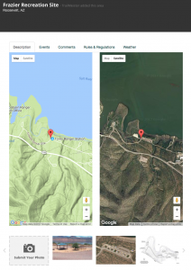
 Frazier Recreation Site, Roosevelt, Arizona
www.trailmeister.com/trails/frazier-recreation-site/
Trailhead Coordinates: 33.66639, -111.12389
A quick two–hour drive from Phoenix will reward you with a fabulous horse camp that combines desert and water scenes. The Frazier Recreation Site is set in the Sonoran Desert on the edge of Theodore Roosevelt Lake in the Tonto National Forest. The area’s low elevation of only 2,200 feet coupled with easy drive times from both Phoenix and Tucson make this a very popular fall, winter, and spring destination spot for horse and mule owners throughout Arizona.
This very popular horse riding and camping area offers a remarkable number of amenities as well as phenomenal riding opportunities. Riders visiting the lakeside Frazier Recreation Site will find eight camping areas; each with corrals, shelter, fire ring, and excellent lake views. The sites all have pull through parking spaces that are suitable for LQ trailers. Potable water spigots and vault toilet facilities are scattered throughout the camp. About the only thing that you won’t find here are showers.
Formed by the Theodore Roosevelt dam the Theodore Roosevelt lake is the largest lake located entirely within the state of Arizona. Completed in 1911 it was the largest masonry dam in the world at the time with a height of 280 feet and a length of 723 feet, while Roosevelt Lake was for a time the world’s largest artificial reservoir.
 Riding opportunities from the camp vary and include, in addition to the many non-official trails, access to the Cottonwood Canyon trail that runs south to the nearby 800-mile-long Arizona Trail stretching the entire length of Arizona. This is desert riding at its finest and you’ll be riding through mesquite as well as cholla and saguaro cacti during your rides in the foothill surrounding Roosevelt Lake. Riders that venture higher into the surrounding mountains will enjoy riding through scrub oak and juniper.
For me, desert rides are all about the views. Broad sweeping vistas showcasing distant ranges that beckon you to visit. From camp a quick glance across the lake to the north east will reveal the Sierra Ancha Mountain range. Closer to camp, and easier to get to, is the Superstition range and the Superstition wilderness that lies to the south. Simply take the Cottonwood trail to the Arizona trail and you’ll be on your way to adventure, legend, lore, and even a lost gold mine!
You may not stumble upon the hidden riches of the Lost Dutchman Mine, but you’ll certainly discover other Sonoran Desert treasures that abound such as petroglyphs, ancient ruins, wildflowers and the beauty of Mother Nature as you explore 160,000 acres of the wilderness area.
QUICK FACT – There are at least 3 other Lost Dutchman’s gold mines besides the one in Arizona’s Superstitions. 1 in Colorado, 1 in California, and another near Wickenburg, Arizona.
Before you visit the Frazier Recreation site be sure to remember that the desert can be an unforgiving area. The stark beauty of the area won’t be hospitable to those not equipped to meet nature on her own terms. Searing heat and a general dearth of water are typical conditions for summer.
For more information, go to: https://www.trailmeister.com/trails/frazier-recreation-site/